
If you are buying a plot, building a house or comparing apartment projects, FAR tells you how much construction the land legally supports. It is one of the first planning numbers to check before a floor plan is drawn.
This guide explains what FAR means in real estate, how to calculate FAR area step by step, the difference between FAR, FSI, built-up area and ground coverage, and the main factors that decide the permitted FAR for a plot in Mysuru.
FAR Full Form in Real Estate
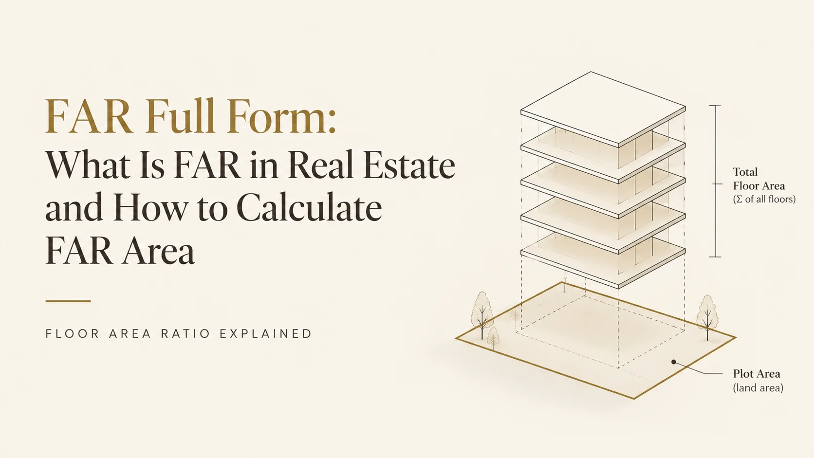
FAR stands for Floor Area Ratio. It is a single number that caps how much total floor space a building can have compared with the land under it. A FAR of 2 means the combined floor area across all floors can be twice the plot area.
You may see FAR written in three ways:
- As a ratio, such as 1:2 or 2.0
- As a decimal, such as 1.75
- As a percentage in older documents, such as 175%
All three express the same relationship. A plot with FAR 1.75 allows built-up floor area equal to 1.75 times its land area.
What Is FAR in Real Estate?
FAR in real estate is a legal limit on building density. Planning authorities use it to control how much floor space can go up on each plot so roads, water, drainage, parking and other infrastructure remain in step with development.
The source draft defines FAR as built-up floor area divided by plot area and notes that the exact permitted number comes from local Development Control Regulations. For Mysuru, the draft uses the MUDA Master Plan 2031 regulations as its planning reference.
FAR does not fix the number of floors on its own. It fixes the total floor area. You may be able to spread that area over fewer wider floors or more narrower floors, subject to height, setbacks and ground-coverage rules.
What FAR includes and excludes
Under the MUDA 2031 rules used in the source draft, the following areas generally do not count toward FAR:
- Open stilt or basement parking used only for parking
- Main staircase, lift shaft, lift well and lift machine room
- Ramps, ventilation ducts, sanitary ducts and overhead tanks
- A security cabin up to the area allowed by the regulation
- Qualifying weather shades within the specified projection limit
The draft states that balconies, corridors and escalators do count. Because each city publishes its own inclusions and exclusions, the local rule book should be checked before design.
How to Calculate FAR Area
Step by step
- Find the exact plot area from the sale deed, Khata or approved layout plan.
- Confirm the land-use zone, road width and permitted FAR with the local planning authority.
- Multiply plot area by FAR to get the total FAR area.
- Multiply plot area by permitted ground coverage to estimate the largest footprint per floor.
- Compare the total FAR area with the allowable footprint to understand how the area may be arranged across floors.
Worked example: a 30 × 40 site in Mysuru
| Item | Value used in the draft |
|---|---|
| Plot size | 30 ft × 40 ft = 1,200 sq ft (about 111 sq m) |
| Zone | Residential (Mixed), MUDA Master Plan 2031 |
| Permitted FAR | 1.75 |
| Maximum FAR area | 1,200 × 1.75 = 2,100 sq ft |
| Maximum ground coverage | 65% in the worked example, giving a 780 sq ft footprint |
| Indicative floor distribution | 2,100 ÷ 780 ≈ 2.7 floor-equivalents |
Using those assumptions, the plot could theoretically support a ground floor and first floor at the full 780 sq ft footprint, plus a smaller upper floor of about 540 sq ft. Road width, setbacks, height and other planning controls can reduce this, so the figure should be treated as an upper-limit planning example rather than a sanctioned design.
Checking an existing building
If a building has 2,400 sq ft of floor area on a 1,500 sq ft plot, its used FAR is 2,400 ÷ 1,500 = 1.6. If the permitted FAR there is 1.75, the draft's example leaves 0.15 FAR, or 225 sq ft, unused.
FAR vs FSI vs Built-up Area vs Ground Coverage
FAR and FSI (Floor Space Index) measure the same relationship under two names. Built-up area and ground coverage are different measures that are often confused with FAR.
| Term | What it measures | How it is shown | Example on a 1,200 sq ft plot |
|---|---|---|---|
| FAR (Floor Area Ratio) | Total floor area of all floors divided by plot area | Ratio or decimal | 1.75 allows 2,100 sq ft in total |
| FSI (Floor Space Index) | Same measure as FAR | Decimal or sometimes percentage | 175% also represents 1.75 |
| Built-up area | Actual floor area constructed, including walls | sq ft or sq m | Could be up to 2,100 sq ft if full FAR is used |
| Ground coverage | Share of plot occupied at ground level | Percentage | 65% means a 780 sq ft footprint |
What Decides the Permitted FAR for Your Plot?
The draft identifies five major factors. Two nearby plots can have different development potential if their road width, zone or other planning conditions differ.
Land-use zone
Residential, commercial and industrial zones can use different FAR tables. Commercial areas often allow more total floor area than residential areas.
Plot size
Larger plots may move into a different FAR or ground-coverage row because more open space, parking and access can be required.
Road width
Wider roads generally support greater development intensity. The draft notes that under the MUDA 2031 framework, the applicable road-width condition can affect which FAR row a plot qualifies for.
Location in the city
The draft describes different development rings in Mysuru and notes that heritage or visual-control zones can add further restrictions.
Bonus FAR, TDR or premium FAR
Some rules allow additional development rights through approved mechanisms such as plot amalgamation, Transferable Development Rights or premium FAR. These are not automatic and must follow the applicable local regulation and sanction process.
Typical Residential FAR in Mysuru
The supplied draft uses the following MUDA Master Plan 2031 values as a planning guide. These figures should be rechecked against the latest amendments before a real purchase or design decision.
| Zone | Plot size | FAR | Maximum ground coverage |
|---|---|---|---|
| Residential (Main) | Up to 2,000 sq m | 1.75 | About 75% to 55%, reducing as plot size grows |
| Residential (Main) | 2,000 to 4,000 sq m and above | 1.50 | About 50% to 45% |
| Residential (Mixed) | Up to 4,000 sq m | 1.75 | About 75% to 50% |
| Commercial (Central) | All sizes in the draft table | 2.50 | About 70% to 55% |
Treat these as a guide, not a substitute for a plot-specific planning check. Road width, amendments, setbacks, height, heritage controls and the exact zoning row can change what is permitted.
Why FAR Matters When You Buy a Plot or a Flat
FAR affects both land value and legal buildability. Two plots of the same size can offer different development potential if their permitted FAR or road conditions differ. For apartment buyers, the important question is whether the constructed floors match the sanctioned development rights.
Before you sign, check:
- The land-use zone and permitted FAR for the plot
- The recorded width of the road the plot faces
- Whether road widening affects the usable plot area
- For a flat, the sanctioned plan and whether the building matches it
- For a flat, the Occupancy Certificate status where applicable
- For redevelopment, how much FAR the existing building has already used
Frequently Asked Questions About FAR
What is the full form of FAR?
FAR stands for Floor Area Ratio. It is the ratio of the total built-up floor area of a building, across all floors, to the area of the plot it stands on. Planning authorities set a maximum FAR for each applicable zone and planning condition.
What is FAR in real estate in simple words?
FAR is the number that tells you how much total floor area you can build on your land. A FAR of 2 means total floor area equal to twice the plot size, subject to the other planning rules that apply to the site.
How do I calculate FAR area for my plot?
Multiply the plot area by the permitted FAR. For a 1,200 sq ft plot with FAR 1.75, the FAR area is 2,100 sq ft. Ground coverage, setbacks, height and road width then affect how that area can be arranged.
Is FAR the same as FSI?
Yes. FAR and FSI both express total floor area divided by plot area. Some planning systems use the term FAR, others use FSI, and older documents may express the same value as a percentage.
Does parking count towards FAR?
Under the MUDA Master Plan 2031 rules cited in the source draft, open stilt parking and parking-only basements are excluded from FAR, along with some common service areas. Because exclusion rules vary, verify the current local regulation before design.
What is the FAR for residential plots in Mysuru?
The source draft uses FAR 1.75 for many Residential Main and Residential Mixed cases under the MUDA Master Plan 2031, with 1.50 for some larger Residential Main plots. The exact permitted FAR still depends on the applicable plot-size, road-width and zoning conditions and any later amendments.
Can I build more than the permitted FAR?
Only through approved routes such as TDR, premium FAR or additional FAR for amalgamated plots where the current local regulations permit them. Building beyond the sanctioned FAR without approval is a planning violation.
Know Your FAR Before You Buy or Build
The FAR full form is Floor Area Ratio, and it is one of the key numbers that decides how much you can legally build on a plot. Multiply plot area by the permitted FAR to estimate the total FAR area, then check ground coverage, road width, setbacks and height to understand how that floor area can actually be arranged.
FAR should be checked before you finalise a plot or freeze a house plan, because the legal development potential of the land affects both design and value.
Know What Your Plot Can Support
Dwara Constructions handles architecture, construction and interiors with one in-house team, and has delivered 150+ projects across Mysuru and Bengaluru since 2016.
Share your plot details and our team can help you review the site conditions, planning constraints and buildable potential before you move into design.
Share Your Plot Details